An Evaluation of Municipal Policies and their Role in Protecting Forests from Development Impacts
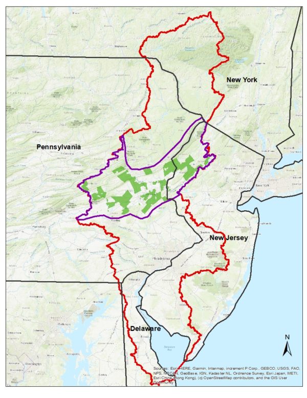
 Over the past eight years, the Center has expanded its reach to the Delaware River Basin, which spans four states and includes 42 counties and 838 municipalities. With the support from the Academy of Natural Science at Drexel University’s Delaware Watershed Research Fund, the Center recently finalized a three-year research project in partnership with Rutgers University and the Pinchot Institute for Conservation to analyze the role of municipal land use controls in forest protection. The goal of the research was to identify areas of the Delaware River Basin that would benefit from improved regulatory protection for important forest lands such as streamside buffers.
In the first phase of the project, an advisory group made up of partners working on forest and streamside buffer policies and projects in the basin was established to help determine where to focus the study. This process resulted in selection of the Highlands and Ridge and Valley physiographic regions of the basin as the priority study area, followed by the random selection of 60 Pennsylvania and New Jersey municipalities within the study area that are representative of the different municipality types and levels of urbanization present there.

In the project’s second phase, the Center conducted a review of municipal codes and ordinances related to streamside buffer and forest protection for 54 of the 60 municipalities. The Center’s 2018 Forest-Friendly Code and Ordinance Worksheet was used for the review. This 52-question worksheet allows an in-depth review of a community’s development regulations in terms of their ability to protect forests from clearing and other impacts during development. The review resulted in a score for each municipality that represents the percent of code elements that measure up to pre-established benchmarks.
Phase 3 involved comparing the municipality scores with a series of landcover metrics, such as the extent of forest within 50-foot, 100-foot, and 300-foot streamside zones. This spatial information was useful to understand the extent to which forest protection policies are related to the amount of forest measured through high-resolution mapping. The analyses were performed at the municipal, county, and state levels. Also in this phase of the project, the Center selected two of the 54 municipalities for a case study analysis to look more closely at how local development regulations may influence forest loss. For each case study community, the Center projected future forest cover under buildout conditions for two scenarios: 1)“status quo” and 2)“conservation.” These case studies illustrate the potential impact of specific development code changes on reducing forest loss and the implications for water quality.
The project results help to strengthen our understanding of what makes forest protection regulations effective and will be used to guide where and how future ordinance work occurs in the basin.
Click here to download the final report
To learn more about this project, contact Julie Schneider at jas@cwp.org
