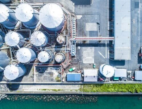

For more than 10 years, stormwater engineers in Carroll County, Maryland have experimented with the retrofit of existing stormwater ponds originally designed to reduce the rate of runoff to downstream receiving streams. Modeling results indicate that these retrofit designs—specifically, enhanced sand filter and wet pond designs—capture and retain enough rainfall that peak flows from the two-year storm are less than those from a wooded site in good condition. Carroll County also observed that the highly eroded streambanks downstream of the retrofits stopped retreating and began to re-vegetate over months or years after the construction of the retrofits.
Given these results, along with research findings that unstable streambanks in headwater streams can recover channel stability with the implementation of upstream stormwater retrofits, Carroll County Bureau of Resource Management and the Center for Watershed Protection (CWP) partnered on a study to examine the influence of these stormwater retrofits on the hydrogeomorphic response of the receiving channels. The study was funded by the Chesapeake Bay Trust’s Pooled Monitoring Initiative grant program in 2016. Two pond retrofits in Carroll County were selected for analysis. Following a paired watershed design, a set of control and treatment watersheds were selected to generate hydrologic, hydraulic, and geomorphic data during the pre-treatment (1 year) and post-treatment (1-2 years) periods. The paired watershed design was selected to allow for isolation of the treatment effects of the retrofitted sites.
Three hypotheses were tested through this research study:
- Hydrology & Hydraulics: The implementation of BMPs retrofitted to meet Carroll County’s sand filter design standard will modify the runoff response from the watershed (hydrograph) resulting in a reduction of the magnitude, duration and frequency of erosive flow rates that meet and or exceed State of Maryland performance standards for stream channel protection.
- Geomorphology: The implementation of these BMPs will create hydraulic conditions that lead to self-recovery of channel stability.
- Sediment Load: The implementation of these BMPs will decrease sediment loadings downstream as a result of reduced bank erosion rates.
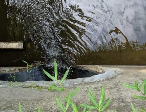
The monitoring setup included rain gauges at three locations that were evenly distributed across the study area, and multiple pressure transducers at each location to continuously measure stage. Baseflow and storm event flow measurements were taken using a YSI Flowtracker to correlate stage and discharge. Continuous stage and discharge data were used to evaluate the runoff response, peak flow rates, and flashiness. Riffle, run and pool monumented cross sections were installed and longitudinal profiles were taken along the study reaches. Bank pins were placed throughout the study sites to capture bank retreat from multiple banks at varying levels of instability. A BANCS (Bank Assessment of non-point source Consequences of Sediment) assessment, as well as measured changes within the stream channel from the cross sections and bank pins were used to estimate and compare sediment loads from the two methods.
Hydrology & Hydraulics Results: The study showed that the enhanced sand filter and wet pond retrofits performed as designed and reduced the magnitude, duration, and frequency of erosive flow rates, reducing the measured runoff curve numbers and simulating a hydrologic regime close to that of the “woods in good condition” performance standard. However, with the relatively short monitoring period, the total number of storm events and the range of events was different between the pre-treatment and post-treatment periods, which made it hard to draw conclusions with confidence to directly compare curve number results pre and post treatment.
Geomorphology & Sediment Load Results: The results for the geomorphology and sediment load portions of the study were more variable. For example, the surveys did show that the bankfull channel area decreases across all the study sites, indicating a potential trend towards stability, but changes in the cross-sectional area between the treatment and control sites were variable and did not show any effect that can be directly attributed to the retrofits. Bank erosion at all cross-sections decreased between the pre- and post-treatment period, except for one of the treatment sites where erosion rates increased. Even though there was quite a variation during this short monitoring period, there is strong evidence when looking at all of the geomorphic data, that as the frequency of erosive flows diminish at the treatment sites the channels will begin to stabilize.
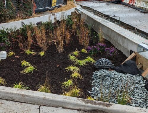
Anecdotal evidence from this study is illustrated in the photos below of one of the treatment sites before retrofit installation (left) and 13 months after installation (right). It is expected that, with the reduced hydraulics within the catchment, these banks will continue a trajectory toward stability as indicated by reduced bank angles and vegetation establishment.

This study established baselines for the hydrologic and geomorphic response that will be built upon by Carroll County’s continued monitoring efforts. More time and continued monitoring will likely be needed to get data for a greater range of storm intensities and to allow bank stability to be fully achieved and measured. The final report for this project can be download here.
To learn more about this project, contact Lisa Fraley-McNeal, Center for Watershed Protection, or Byron Madigan, Carroll County Bureau of Resource Management.
Acknowledgement: The project was supported by a research grant awarded to Carroll County, MD from the Chesapeake Bay Trust’s Restoration Research Grant Program. Support was provided by Rich Starr, Ecological Planning and Restoration, Mark Secrist, US Fish and Wildlife Service, Chesapeake Bay Field Office, and Carroll County, MD Survey.